Recent searches
Search options
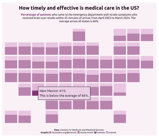
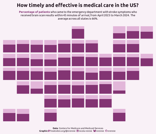
For this week's #TidyTuesday, we're looking at healthcare efficiency in the USA I wanted to create a very minimalist data-art plot, with tooltips that give more information
Map grid from {geofacet}
Interactive tooltips with {ggiraph}
Styling with CSS
@nrennie Damn, South Carolina.
@mzedp South Carolina is 78%. Washington DC is the very low one with 26%.
(I might add some state labels to the static version as well...)


